It’s been nearly a month since I have blogged and I’ve fallen a little behind.
Since last I posted I have activated five SOTA summits and re-visited five National Parks. All done while I had a week off work after the Labour Day long weekend.
10 March 2013 VK3/VC-025 Mt Dandenong and Dandenong Ranges NP
I’ve been here before, for my first SOTA activation, and it seemed like the ideal summit to visit on the way to lunch with Mum on my birthday. Setting up near the same place as last time I got on air before the UTC rollover for 18 QSOs and a further 18 QSOs after the changeover. These QRP QSOs also qualify for the Keith Roget Memorial National Parks Award as I was located just inside both the SOTA activation zone and the Dandenong Ranges National Park.
Access to the Mt Dandenong summit can be gained by walking up from Ridge Road either against the traffic flow on Observatory Rd or up Kyeema Track opposite the Mount Dandenong Arboretum. This is the path I took in. There enough room at the end of Kyeema Track to park one car and leave the gate clear. The track heads up to the left after about 200 metres and climbs its way up to the Observatory Rd.
 |
| Part of activation zone also in Dandenong Ranges National Park |
11 March 2013 VK3/VC-006 Mt St Leonard and Yarra Ranges NP
This summit is a leisurely stroll from the gated entrance on Monda Rd, about 3.4 km east of Myers Creek Rd. There are two ways up, one along the management vehicle road and a track alongside the power lines. I went up the road and came down the power line track.
 |
| Access track to Mt St Leonard |
 |
| Antenna set up |
On the summit I set up just south of the fenced compound and made 21 QSOs before 0000z and 14 QSOs after the change, including four summit to summit QSOs.
I was joined on the activation by many flies and a black snake who kept his distances – thankfully.
This location also qualifies for the Keith Roget Memorial National Parks Award as part of the Yarra Ranges National Park.
12 March 2013 VK3/VT-046 Mt Tassie and Tarra Bulga NP
 |
| Black Saturday memorial |
Still enjoying my time off work I headed out east to Mt Tassie. I drove to the summit looking for a location that was out of the sun as it was forecast to be a very warm day. I then drove back down the Traralgon – Balook Rd about 800 metres to an old quarry site I had passed on the way up from Traralgon. Here the Great Strzelcki Walking track passes along to the northern edge of the activation zone. At the top of the track is a table and a memorial to those who lost their lives during the Black Saturday fires in 2009.
 |
| Operating out of the sun |
Sitting behind the fence, out of the sun, I made 13 QSOs before 0000z and three after. I didn’t hang around long after the change as I wanted to also visit the nearby Tarra Bulga National Park.
A quick pack up and a walk back down the track to the quarry and I was on my way to the the National Park for lunch.
At the Tarra Bulga National Park I made five QRP QSOs, adding to my QRP park activations total.
 |
| Mt Tassie from Mt Hooghly |
12 March 2013 VK3/VT-049 Mt Hooghly and Morwell NP
I followed Peter, VK3PF’s directions here, and walked out of the activation zone and then to the summit in hope of finding some shade. The best I could find was a tree among some blackberry shrubs where I quickly set the antenna to make the activation and get out of the heat.
In my haste I didn’t check the RCA connectors on my linked dipole and, after five poor signal reports, I went to the end of the antenna and found the two RCA connectors touching making one end of the dipole 10 metres longer than needed. After correcting this small problem it was back to the usual good reports.
 |
| Billys Creek Visitor Area |
I made six QSOs from the hot Hooghly hill before packing up, taking a couple of photos and heading back home via the Morwell National Park.
At Morwell National Park I made nine QRP QSOs from the Billy Creek Visitor Area. This location was suggested to me by Peter, VK3PF, as being a better location than the Kerry Rd Visitor Area which is in a valley.
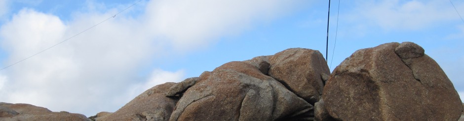
13 March 2013 VK3/VN-003 Federation Range and Yarra Ranges NP
 |
| Working from the rock |
Parking at the Lake Mountain Alpine Resort I walked up Royston Trail to Triangle Junction. The 1.2 km walk is easy going on a marked ski trail.
At the triangle I made the station on a rock out of the sun. I made 16 QSOs from here with 9 being before 0000z. This location also qualifies for the Keith Roget Memorial National Parks Award as part of the Yarra Ranges National Park.
 |
| View west from Triangle Junction |
The bush around here, as well as the nearby town of Marysville, was devastated by the Black Saturday fires in 2009 and large parts of the landscape is dead trees reaching skyward.
After activating the summit I walked back down to the car and, after stopping to take some more photos, headed off to Lake Eildon National Park.
At Lake Eildon National Park I made 8 QRP QSOs taking the number of National Parks I have activated using 5 Watts or less to 18.
After finishing at Lake Eildon National Park, with an hour and 1/2 to spare, I stopped by the Warramate Hills Flora and Fauna Reserve to check out access to VK3/VC-029 Briarty Hill. Since I wasn’t planning an activation, and really didn’t have time anyway, I set out to see how far toward the top I could get in 45 minutes.
At first I headed along the main track and then turned left and followed a mountain bike track in to the bush until it reappeared on the side of the hill, with what looked like a clear track straight up the side of the hill. I followed the track up, had a brief encounter with a goat, and then found myself on the access road again. This was good as the access road actually leaves the park and travels through private property and returns. Taking this direct route up mean I didn’t need to jump fences or enter property where I shouldn’t.
It also seemed to reduce the distance I needed to travel. After 45 minutes I thought I was pretty close to the top and after 49 minutes I was there. No radio, but at the top none the less.
I followed the same path back down, except I didn’t go back on to the mountain bike track, preferring to continue across the paddock back to the access road. I was back at the car inside the hour and 1/2 I had set myself.
On studying the map, I think I have taken about 3 km off the alternative route.
I’ll be back here soon to activate the summit.
73